
Rudranath Trek
Trek near Tharali, Uttarakhand
7.9 km from Tharali
The nearest town, for stays, food and fuel.
The Rudranath Trek is one of the most revered and rugged pilgrimage routes in the Garhwal Himalayas of Uttarakhand, leading to the isolated Rudranath temple dedicated to Lord Shiva. Hikers journey through dense rhododendron groves, steep forest ridges, and sweeping high-altitude alpine meadows before reaching the sacred shrine set against dramatic mountain backdrops. Travellers and devotees undertake this demanding journey to test their endurance, enjoy sweeping vistas of Himalayan peaks, and experience an untouched wilderness setting.
Getting there
By road
- From TharaliNearest town1 hr 15 min · 29 km
- From Dehradun5 hr 5 min · 248 km
- From New Delhi8 hr 20 min · 460 km
- From Chandigarh8 hr 45 min · 417 km
Typical drive times without traffic. Stations and airports from OLA Maps; distances and typical drive times from OpenStreetMap (© OpenStreetMap contributors); notes from creators' Reels.
About Rudranath Trek
Written with AI from map data and general knowledge. Check prices and timings locally before you go.
The Journey to Rudranath
The Rudranath Trek holds a distinguished place among Himalayan journeys as the fourth shrine in the sacred Panch Kedar pilgrimage circuit. Unlike some of the other shrines that have motorable roads drawing closer each year, Rudranath remains deliberately secluded, insulated by rugged topography and vast stretches of wild mountain slopes. Devotees revere the temple as the place where the face, or 'mukh', of Lord Shiva is worshipped, housed within a natural stone sanctum surrounded by towering peaks.
The trail typically commences from lower trailheads in the Chamoli region, winding steadily upward through mixed temperate woodlands of oak, pine, and rhododendron. As you gain elevation, the canopy thins to reveal wide grasslands that ripple in the mountain breeze. The combination of intense physical exertion, quiet forest solitude, and sacred lore gives the Rudranath Trek an atmosphere distinctly different from standard commercial trekking circuits.
Landscape and Trail Highlights
The terrain along the Rudranath Trek shifts dramatically across vertical climate zones, making every stage of the hike a visual discovery. The initial miles demand steady uphill climbing through shaded woodlands where streams crisscross moss-covered boulders and birds call through the thick canopy. In late spring, flowering rhododendron blooms blanket the hillsides in vibrant shades of pink and crimson, providing natural colour against deep green foliage.
Emerging above the timberline brings you onto the famed high-altitude meadows, known locally as bugyals, including the breathtaking Panar Bugyal. These open expanses offer expansive panoramas of prominent Garhwal peaks such as Nanda Devi, Trishul, and Chaukhamba. Walking along the exposed ridges, with clouds rolling through deep valleys below and alpine wildflowers dotting the turf, is one of the defining highlights of the entire excursion.
Read more
Best Time to Visit Rudranath
The trekking window for Rudranath is dictated by Himalayan weather and the seasonal opening of the temple sanctum. The trek is traditionally open between May and October, divided into two distinct trekking seasons: summer and autumn. During May and June, snow has melted from the major walking paths, temperatures are pleasant during daytime hours, and the lower forests are alive with spring blossoms. Days are generally clear, allowing for expansive views of snow peaks, though nights remain crisp and cold at higher camps.
The monsoon months of July and August bring heavy rains to Uttarakhand, raising the likelihood of slippery trails, reduced visibility, and slope instability in the lower reaches. While some intrepid pilgrims visit during this period when the meadows are exceptionally lush, the post-monsoon window of September and October is widely considered the finest time for hiking. Autumn brings crisp air, dry walking trails, and unusually sharp visibility, revealing the surrounding snow-capped summits against deep blue skies before winter snowfall closes the route for the season.
Fitness and Preparation for the Trek
The Rudranath Trek is classified as moderate to strenuous due to its steep, unrelenting gradients and the lack of gradual switchbacks on several sections. Hikers climb thousands of feet over a relatively short distance, placing significant strain on calf muscles, knees, and cardiovascular endurance. Preparing with regular cardio exercise, stair climbing, and strength conditioning several weeks prior to the journey is essential for an enjoyable experience.
Acclimatisation should be respected as you cross into high-altitude territory. Ascending at a measured pace, staying properly hydrated, and listening to your body will help stave off altitude sickness. Trekkers should carry a sturdy pair of broken-in trekking boots, thermal base layers, a waterproof shell, a reliable headlamp, and trekking poles to absorb impact on the steep descents. It is also wise to carry your own refillable water bottles and purification tablets, as water sources can be sparse along ridge sections.
How to Reach the Rudranath Trailhead
Reaching the starting points for the Rudranath Trek involves travelling deep into the Garhwal district of Chamoli. The nearest major railhead is at Rishikesh, and the closest domestic airport is Jolly Grant Airport near Dehradun. From these hubs, visitors can journey by road along the Badrinath highway, tracking the course of the Alaknanda and Mandakini rivers past holy river confluences such as Devprayag, Rudraprayag, and Karanprayag.
From the central hubs of Gopeshwar or Chamoli, travellers take local mountain roads to traditional starting villages such as Sagar, Mandal, or alternate entry paths connected through the Tharali and Pindar valley region. Mountain roads can experience delays due to weather or maintenance, so it is recommended to factor in spare transit time. Once at the roadhead, all travel continues strictly on foot along marked mountain trails.
Places to Visit Nearby
The region surrounding the trek is steeped in natural charm and Himalayan heritage, offering several worthwhile stops before or after your climb. In the nearby river valleys, the confluences of Karanprayag, where the Alaknanda meets the Pindar River, and Nandprayag provide peaceful waterside spots with traditional temples. Further up the Pindar valley near Tharali, local villages offer an intimate glimpse of terraced mountain farming and Kumaon-Garhwal border culture.
Heritage lovers can explore the ancient temple complex of Adi Badri, a cluster of historic stone shrines dating back to the early medieval era. To the north, the town of Jyotirmath serves as a primary base for high-altitude expeditions and offers access to alpine routes toward Pangarchula and the Nanda Devi sanctuary fringe. Exploring these surrounding valleys offers a rich complement of cultural history to the untamed wilderness encountered on the Rudranath trail.
Where to Stay for the Rudranath Trek
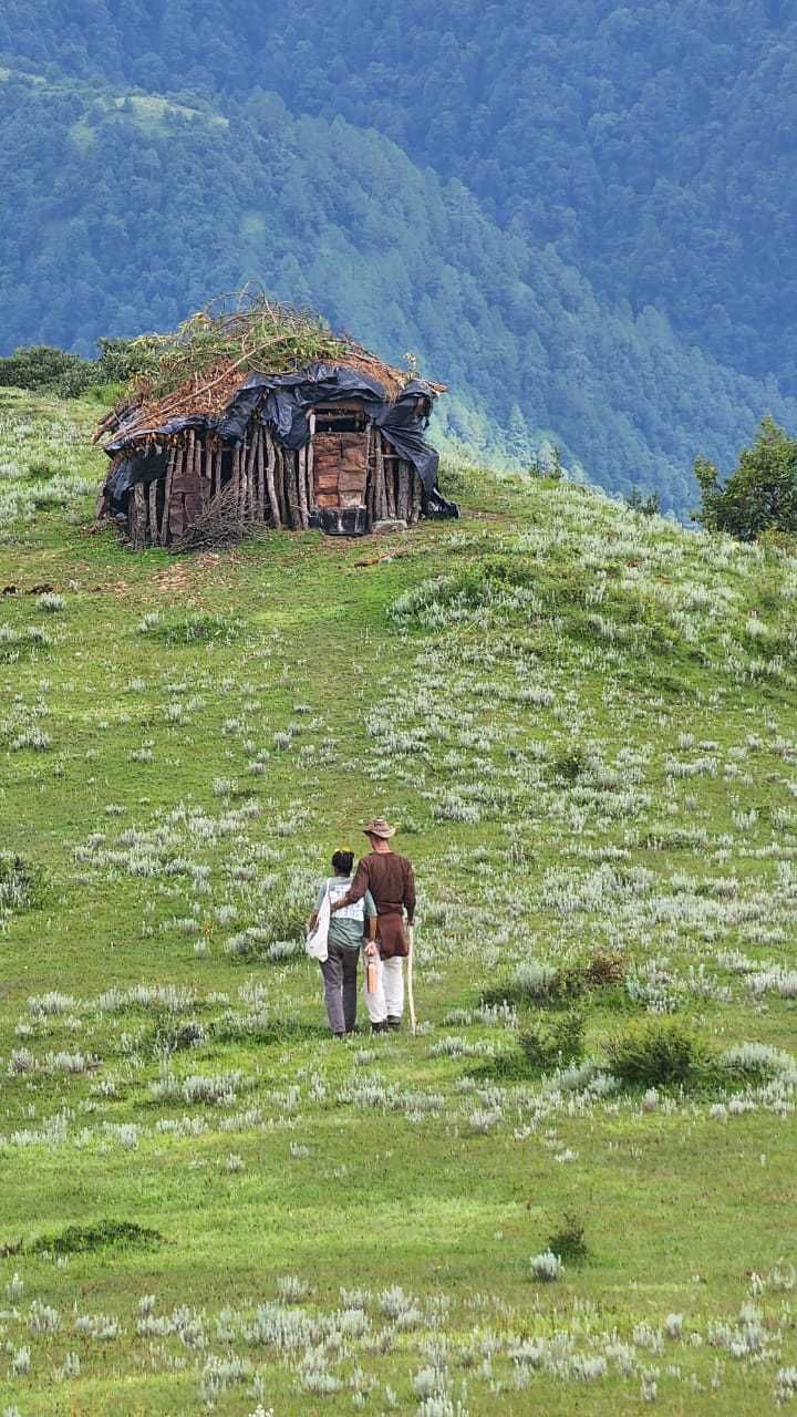
Accommodation options along the Rudranath Trek itself are rugged and basic, reflecting the isolated nature of the terrain. Near the intermediate stops and meadow clearings, local villagers operate seasonal tin shelters and simple tent encampments during the active pilgrimage months. These shelters provide modest sleeping blankets and simple home-cooked meals, giving trekkers a warm place to rest out of the wind.
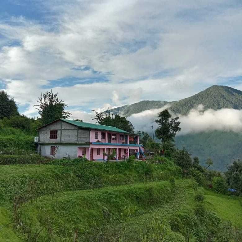
At the roadheads and base villages around Gopeshwar, Tharali, and Sagar, visitors can choose from comfortable family-run homestays, small community guesthouses, and scenic mountain campsites. Travellers can find and book homestays, outdoor camps, and nature stays in the surrounding valleys on HireACamp before heading out on the trail.
Frequently asked questions
How difficult is the Rudranath Trek?
The trek is rated moderate to strenuous because of continuous steep climbs, rugged stone paths, and substantial elevation gain. It requires good cardiovascular fitness and prior experience with hill walking.
Can beginners do the Rudranath Trek?
Beginners with excellent physical fitness and prior preparation can complete the trek, but it is challenging due to the steep terrain. Those with no hiking background may find the long daily ascents particularly taxing.
What is the best season to attempt the Rudranath Trek?
The ideal months are May to June for pleasant weather and green pastures, and September to October for crystal-clear mountain views and dry trail conditions.
What kind of clothing should I pack for the trek?
Pack a multi-layered clothing system including breathable base layers, warm fleece or down jackets for cold evenings, and a windproof, waterproof outer shell. Sturdy hiking boots and woollen socks are essential.
Are stays available directly on the trail to Rudranath?
Yes, basic seasonal huts and meadow tents run by local shepherds and villagers are available along the route during the pilgrimage season. For more comfortable homestays and established base camps before your trek, you can explore listings on HireACamp.
Where you'll be
Hariyali Resort, VIllage - Gwar, Post Office - Gwar Dewaldhar, Next to Sagar Village bridge, Tharali · 2 stays nearby shown with prices
Stays near Rudranath Trek
Book a place to stay close by
More places near Rudranath Trek
Within 20 km
Built from 0 Instagram posts by 0 creators. Every tip links back to the post it came from, and where creators disagree we show both sides.






