
Bekaltal
Lake near Lohajung, Uttarakhand
4 km from Lohajung
The nearest town, for stays, food and fuel.
Bekaltal is a scenic high-altitude lake nestled amidst dense oak and rhododendron forests in the Chamoli district of Uttarakhand. Situated along the renowned trekking trail leading to Brahmatal, it serves as a cherished campsite for trekkers beginning their journey from Lohajung. Visitors are drawn to its calm, dark waters, pristine alpine atmosphere, and the peaceful shelter provided by the surrounding Himalayan woods.
Getting there
By road
- From LohajungNearest town2 hr · 48 km
- From Dehradun6 hr 20 min · 276 km
- From New Delhi9 hr 40 min · 488 km
- From Chandigarh10 hr · 445 km
Typical drive times without traffic. Stations and airports from OLA Maps; distances and typical drive times from OpenStreetMap (© OpenStreetMap contributors); notes from creators' Reels.
About Bekaltal
Written with AI from map data and general knowledge. Check prices and timings locally before you go.
About Bekaltal
Bekaltal is an alpine lake resting deep within the Garhwal Himalayas near Lohajung in Uttarakhand. Surrounded by ancient brown oak, cedar, and rhododendron groves, the lake holds deep cultural and natural significance in the region. Local folklore associates the tranquil waters with regional mountain deities, and the area is treated with quiet reverence by the villagers who graze their livestock in nearby meadows during the warmer seasons.
Unlike wide open glacial tarns situated above the tree line, Bekaltal offers a sense of seclusion and shelter. Its surface reflects the tall, moss-draped branches of the surrounding canopy, giving the water a distinctive deep-green tint. For trekkers traversing the winter and spring routes toward the Brahmatal ridge, reaching the quiet shores of Bekaltal marks one of the most rewarding milestones on the climb.
The Trek to Bekaltal
The journey to Bekaltal usually begins at Lohajung, a mountain hamlet that acts as the primary base for multiple Himalayan trails in Chamoli. From Lohajung, the trail ascends gradually through rustic mountain settlements such as Mandoli and Budhabal. As the path leaves the village terraces behind, it enters a serene forest belt where the sound of mountain streams accompanies the walk.
The trail climbs steadily under a thick canopy, crossing small wooden bridges and clear water springs. The walking surface alternates between packed dirt, stone-paved forest tracks, and exposed tree roots. During the colder months, the mud gives way to hard-packed snow and patches of frost. The distance from the base village to Bekaltal can comfortably be covered within four to five hours of steady walking, making it an accessible and enjoyable mountain hike for novices as well as seasoned trekkers.
Read more
Best Time to Visit Bekaltal
Bekaltal presents completely different landscapes depending on the season you choose to explore it. During the spring months of March and April, the surrounding woods burst into vibrant color as rhododendron flowers bloom in shades of crimson and pink. The weather remains pleasant during the day, with crisp air and clear skies offering distant views of snow-draped ridges through gaps in the forest.
Autumn, running from late September through November, offers golden tones and the clearest atmospheric conditions. Mountain views are sharp, and daytime temperatures are ideal for outdoor walking. In the depths of winter, from December to February, Bekaltal transforms dramatically into a frozen landscape. Heavy snowfall coats the trees, the trail requires careful footing over snow, and the lake surface often freezes over completely into a thick layer of ice, creating a classic winter wilderness setting.
Landscape and Wildlife Around Bekaltal
The forest corridor enclosing Bekaltal is home to a rich variety of Himalayan flora and fauna. The temperate broadleaf and coniferous forests consist largely of high-altitude oak, silver fir, and rhododendron trees, with rich mosses and lichens clinging to the bark. In warmer months, the shores and clearing banks bloom with alpine grasses and wild mountain blossoms.
Bird enthusiasts can observe numerous Himalayan avian species flitting through the branches, including Himalayan monals, laughingthrushes, treecreepers, and crested black tits. Mammals such as barking deer, yellow-throated martens, and mountain foxes inhabit these upper forest tracts, although they tend to stay elusive and shy away from established trekking paths. The overall quiet of the lake basin makes it an ideal spot for listening to the wind rustling through the canopy and taking in the undisturbed mountain silence.
Places to Visit Near Bekaltal
Bekaltal is part of a landscape rich in trekking routes and sacred high-altitude geography. Further up along the same ridge trail lies Brahmatal, an alpine lake set amid windswept meadows with panoramic views of giant peaks like Trishul and Nanda Ghunti. Trekkers venturing beyond Bekaltal often use the lake as their first night stop before pushing higher toward these open ridgelines.
The base village of Lohajung is also historically known as the traditional start point for the trek toward Roopkund and the Sili Samudra Glacier. Across the deeper valleys of Chamoli lie sacred shrines and revered points such as the Nanda Devi Siddhpeeth at Kurur and the trailheads leading toward Rudranath. Travelers descending from the trek can also explore regional riverside towns like Karnaprayag, where the Alaknanda and Pindar rivers merge in a powerful confluence.
How to Reach Bekaltal
To reach Bekaltal, travelers first make their way to the base settlement of Lohajung. The journey from major transit hubs in Uttarakhand involves scenic road travel through the Garhwal hills. The nearest railway stations are at Rishikesh and Kathgodam, while the closest airport is Jolly Grant Airport near Dehradun. From these hubs, shared taxis and state buses run toward Karnaprayag and Tharali, followed by mountain roads leading up to Lohajung.
From Karnaprayag, the drive winds along the Pindar River toward Tharali and Dewal before climbing steep switchbacks up to Lohajung. Once in Lohajung, vehicles are left behind, and the remainder of the journey to Bekaltal must be completed entirely on foot along the forest footpath. Due to the high altitude and changing mountain weather, it is advisable to arrive in the base village well before sunset and start the trek early in the morning.
Packing and Trekking Tips
Preparation is key when venturing into the high-altitude forests of Bekaltal. Sturdy trekking boots with good ankle support and reliable tread are essential for negotiating forest mud, loose stones, and winter snow. Trekking poles can greatly relieve strain on your knees during both the ascent and the descent through the steep sections.
Layering your clothing is vital, as temperatures drop sharply as soon as the sun dips below the ridge line. Carry thermal base layers, a fleece jacket, a windproof outer layer, and a heavy down jacket for the evenings. Even in summer, nights around the lake can be remarkably cold. Keep your electronics protected from freezing temperatures, pack a reliable headlamp, and ensure you carry adequate water bottles and purification tablets, as natural sources can freeze during peak winter months.
Where to Stay Near Bekaltal
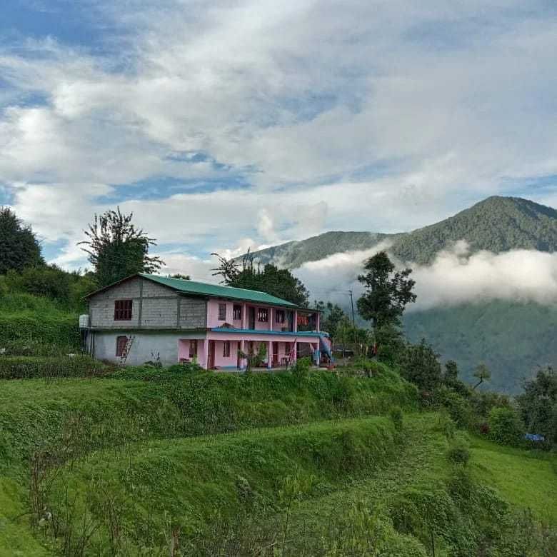
Accommodation choices depend on which stage of the journey you are planning. In the base village of Lohajung, trekkers can find simple local guesthouses and family-run homestays providing basic amenities, warm beds, and freshly prepared local Garhwali meals. Staying a night in the village helps your body adjust to the higher altitude before you begin climbing the following day.
At Bekaltal itself, overnight stays are strictly tented. Camping in designated clearings near the lake allows visitors to experience the crisp mountain air under a sky full of stars. You can discover comfortable camps, rustic homestays, and outdoor stays across the Lohajung and Bekaltal route on HireACamp to plan your mountain retreat smoothly.
Frequently asked questions
How long does it take to trek from Lohajung to Bekaltal?
The trek from the base village of Lohajung to Bekaltal typically takes around four to five hours at an easy to moderate pace. The trail covers forested terrain with a steady upward climb.
Does Bekaltal freeze in winter?
Yes, during the peak winter months of December, January, and February, temperatures drop well below freezing, and the lake surface often freezes over with ice.
Is the Bekaltal trek suitable for beginners?
Bekaltal is widely considered beginner-friendly due to its well-defined forest trail and gradual elevation gain. However, good basic physical fitness and appropriate warm gear are essential.
Can I camp right beside Bekaltal?
Trekkers usually pitch tents in established forest clearings located a short walking distance from the water's edge to help protect the lake's delicate alpine ecology.
What is the nearest major town to Bekaltal?
Karnaprayag is the nearest major town and transport transit point, situated at the confluence of the Alaknanda and Pindar rivers.
Where you'll be
Lohajung, Brahmatal Trek, Karnaprayag · 2 stays nearby shown with prices
Stays near Bekaltal
Book a place to stay close by
More places near Bekaltal
Within 20 km
Built from 0 Instagram posts by 0 creators. Every tip links back to the post it came from, and where creators disagree we show both sides.






