
Rupin Pass Trek
Trek near Dodra, Himachal Pradesh
10 km from Dodra
The nearest town, for stays, food and fuel.
The Rupin Pass Trek is a high-altitude crossover trek connecting the Garhwal Himalayas with the dramatic landscapes of the Kinnaur Valley in Himachal Pradesh. Renowned for its shifting scenery, the route follows the roaring Rupin River past hanging villages, glacial amphitheaters, and alpine meadows before climbing to an elevation above fifteen thousand feet. Trekkers are drawn to its diverse terrain, iconic waterfall campsites, and sweeping vistas of the Kinnaur Kailash range.
Getting there
By road
- From DodraNearest town33 min · 12 km
- From Dehradun7 hr 35 min · 313 km
- From Chandigarh7 hr 35 min · 306 km
- From Ludhiana9 hr 35 min · 407 km
Typical drive times without traffic. Stations and airports from OLA Maps; distances and typical drive times from OpenStreetMap (© OpenStreetMap contributors); notes from creators' Reels.
About Rupin Pass Trek
Written with AI from map data and general knowledge. Check prices and timings locally before you go.
The Trail and Landscape of Rupin Pass
The Rupin Pass Trek is celebrated among Himalayan trekkers for its dynamic terrain that transforms with almost every day of walking. Beginning amid warm, temperate woodlands and terraced apple orchards, the trail quickly cuts into deep gorges carved out by the turbulent waters of the Rupin River. As you follow the water upstream, dense thickets of blue pine, deodar, and oak gradually give way to open silver birch groves and vibrant rhododendron patches.
Beyond the tree line, the geography shifts into wide glacial valleys framed by towering cliff faces. The upper sections of the trail traverse snowfields, frozen streams, and moraine fields beneath sharp ridgelines. Reaching the pass itself requires climbing through an iconic steep gully of snow and scree. Standing atop Rupin Pass, trekkers are greeted by an expansive panoramic view of the Kinnaur Kailash range and the sweeping descent into the lush Sangla Valley of Himachal Pradesh.
Key Highlights along the Rupin Pass Trek
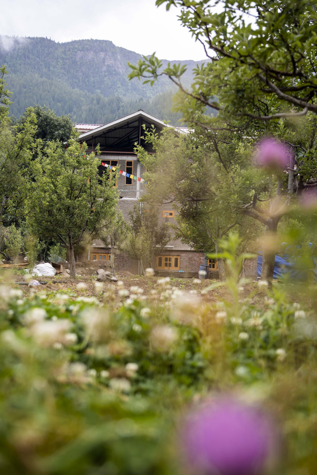
One of the most memorable human settlements along the trail is Jakha, famously known as the hanging village due to its precarious perch on a steep mountain slope. The village features traditional wooden houses with slate roofs, vibrant apple orchards, and terraced fields. Walking through Jakha provides a rare window into the self-sufficient, warm lifestyle of remote Himalayan communities in the Dodra Kwar region.
Another defining natural feature is the series of amphitheater-like waterfalls feeding the Rupin River. Trekkers often camp at meadows overlooking the upper and lower waterfalls, where snowmelt cascades hundreds of feet down sheer rock walls. During early summer, these waterfalls are often bordered by massive snow bridges that span the riverbed, creating natural tunnels of packed ice. Crossing the final snow corridor to reach the pass and sliding or carefully navigating down toward Kinnaur provides an exhilarating outdoor experience.
Read more
Best Time to Do the Rupin Pass Trek
The Rupin Pass Trek is accessible during two distinct seasons each year, each presenting a very different visual character and trail condition. The first trekking window falls in late spring and early summer, running from mid-May through June. During this period, the upper reaches are blanketed in substantial snow, and snow bridges across the river are still intact. The valley meadows begin to green, and wildflowers start blooming along the lower slopes.
Trekkers avoid the monsoon months of July and August because high rainfall in the lower valleys causes landslides, swollen rivers, and unstable trail conditions. The second trekking window opens in autumn, spanning from mid-September through late October. In autumn, the snow has largely melted away, leaving the mountain air remarkably crisp and transparent. The surrounding foliage turns rich shades of gold and amber, offering sharp, cloud-free views of the snowbound peaks across the Kinnaur region.
How to Reach the Trailhead
Reaching the starting zones of the Rupin Pass Trek involves travel across mountain roads in either Uttarakhand or Himachal Pradesh, depending on the chosen route itinerary. The classic crossing generally initiates from the Tons Valley side in Uttarakhand, often reached by road from Dehradun, which has major railway and regional air connections. From Dehradun, mountain highways wind through Mussoorie, Purola, and Mori to reach trailheads such as Dhaula.
Alternatively, routes can be approached from Himachal Pradesh via Shimla, traveling onward across mountain roads toward Rohru and the Dodra Kwar valley to link up with villages like Jakha. On completing the trek on the northern side, trekkers emerge in the Sangla Valley in Kinnaur, from where road transport connects back toward Shimla and Chandigarh via the Hindustan-Tibet highway. Because remote mountain roads are subject to weather variations, check local road conditions and seasonal transport schedules before departing.
Fitness and Packing Preparation
Because the trek reaches altitudes well above four thousand meters and involves sustained ascents over rough terrain, it requires a solid baseline of cardiovascular endurance and leg strength. Preparing with regular running, hill walking with a weighted backpack, and stair climbing in the weeks prior to the journey is strongly recommended. Prior trekking experience at moderate altitudes is valuable for recognizing the early symptoms of acute mountain sickness.
Packing requires preparation for significant temperature extremes. Daytime trekking in lower valleys can be warm, while nights at high-altitude camps frequently drop below freezing. A sturdy four-layer clothing system is essential, including thermal base layers, a fleece, an insulated down jacket, and a wind-and-waterproof outer shell. Sturdy, broken-in trekking boots with deep lugged soles, UV-protection sunglasses, trekking poles, thermal gloves, and personal water purification gear are essential items on this remote trail.
Places to Explore Nearby
The Rupin Pass Trek leads directly into the Kinnaur district, providing access to scenic Himalayan settlements and historic temples. At the trek finish, the Sangla Valley is home to historic villages such as Kamru, famous for its multi-story wooden fort tower and shrines. Further along the valley, Chitkul sits as the last inhabited village near the border along the Baspa River, known for its wooden architecture and riverside walks.
Across the Sutlej Valley lies Kalpa, offering uninterrupted direct views of the sacred Kinnaur Kailash peak. Kalpa is surrounded by dense pine forests and apple orchards, with heritage sites and traditional Himachali temples reflecting an ancient blend of Hindu and Buddhist traditions. To the south in the Tons Valley, the historic Mahasu Devta Temple at Hanol stands as a significant pilgrimage destination celebrated for its stone and wood craftsmanship.
Where to Stay around Rupin Pass
While on the trek itself, accommodation is largely self-contained wilderness camping in alpine meadows and beside glacial streams, with occasional night stops in traditional village homestays in places like Jakha. These village stays provide basic shelter, local home-cooked meals, and authentic insight into traditional mountain hospitality.
For stays before embarking on the trek or after coming down into the Kinnaur and Shimla valleys, a broad variety of lodging options is available. You can find rustic campsites, boutique homestays, and quiet village guesthouses on HireACamp. Arranging your starting and finishing accommodations in advance allows you to rest comfortably before beginning the rigorous mountain crossing and unwind properly after crossing the pass.
Frequently asked questions
How difficult is the Rupin Pass Trek?
The trek is rated moderate to difficult due to its high altitude, long daily distances, and steep climbs over snow and scree near the pass. Trekkers should have good physical stamina, cardiovascular endurance, and prior high-altitude hiking experience.
What is the highest altitude reached on the trek?
The pass crossing sits at an elevation of approximately fifteen thousand two hundred and fifty feet. The ascent requires proper acclimatization over several days to avoid altitude sickness.
Where does the Rupin Pass Trek start and end?
The classic route begins on the Garhwal side near Dhaula in Uttarakhand, climbs along the Rupin River through Jakha in Himachal Pradesh, and concludes in the Sangla Valley of Kinnaur.
Can beginners do the Rupin Pass Trek?
While ambitious beginners with excellent fitness and determination have completed it, it is generally recommended for individuals who have already completed at least one moderate multi-day high-altitude Himalayan trek.
Is there mobile phone connectivity on the trail?
Mobile network coverage is extremely scarce along the route. You may encounter intermittent signal near lower trailhead villages, but connectivity is completely absent throughout the high-altitude camps and pass crossing.
Where you'll be
Rupin Pass, village Jakha, 171221, Dodra Kwar · 1 stay nearby shown with prices
Stays near Rupin Pass Trek
Book a place to stay close by
More places near Rupin Pass Trek
Within 20 km

Built from 0 Instagram posts by 0 creators. Every tip links back to the post it came from, and where creators disagree we show both sides.






