
Roopkund Trek Start Point
Trek near Wan
4.5 km from Wan
The nearest town, for stays, food and fuel.
Roopkund Trek Start Point lies in the remote mountain landscapes of Chamoli district in Uttarakhand, serving as the threshold for one of the most celebrated high-altitude trails in the Garhwal Himalayas. Adventurers and mountain enthusiasts gather here to leave motorable roads behind and step onto the path leading toward the mysterious glacial waters of Roopkund Lake. The staging area offers sweeping views of forested valleys and acts as an essential acclimatization base before entering higher elevations.
Getting there
By road
- From WanNearest town3 min · 1.2 km
- From Dehradun6 hr 50 min · 303 km
- From New Delhi10 hr 5 min · 515 km
- From Chandigarh10 hr 30 min · 472 km
Typical drive times without traffic. Stations and airports from OLA Maps; distances and typical drive times from OpenStreetMap (© OpenStreetMap contributors); notes from creators' Reels.
About Roopkund Trek Start Point
Written with AI from map data and general knowledge. Check prices and timings locally before you go.
Understanding the Roopkund Trek Start Point
The Roopkund Trek Start Point marks the transition between settled Himalayan hamlets and the austere high-altitude wilderness of Chamoli. Situated deep within the Garhwal region of Uttarakhand, this staging ground is surrounded by steep terraced hillsides, rushing mountain streams, and dense stands of native trees. Trekkers use this spot to organize logistics, review their gear, and prepare their minds and bodies for the challenging ascent into the upper reaches of the Himalayas.
Historically, the paths branching out from this trailhead were walked by local shepherds grazing their flocks in the alpine grasslands, as well as pilgrims participating in the sacred Nanda Devi Raj Jat Yatra. Today, it remains an atmospheric outpost where the rhythm of everyday village life contrasts with the adventurous energy of travelers embarking on multi-day expeditions. The air here is crisp, clear, and carries the faint scent of pine and burning wood from nearby stone hearths.
The Landscape Along the Route
Beginning the trek from this staging point introduces hikers to an astonishing progression of ecological zones. The initial sections meander through deeply shaded forests dominated by brown oak, horse chestnut, and blooming rhododendron trees that burst into vibrant pink and scarlet hues during the spring months. As the trail climbs, clear mountain streams crisscross the dirt paths, fed directly by the melting snows of higher massifs.
Beyond the tree line, the scenery transforms dramatically into vast expanses of undulating alpine meadows known locally as bugyals. Ali Bugyal and Bedni Bugyal represent some of the largest and most picturesque grazing grounds in Asia, offering panoramic perspectives of prominent Himalayan giants such as Trishul and Nanda Ghunti. Higher still, vegetation gradually gives way to loose scree, moraine fields, and towering glacial amphitheaters.
Read more
Best Time to Visit Roopkund Trek Start Point
The staging ground and the subsequent high trail experience two distinct trekking seasons each year, shaped by the Himalayan mountain climate. The first window opens in late spring and early summer, typically running from May to June. During these months, the lower valley temperatures are comfortable, lingering winter snows steadily recede from the lower ridges, and the rhododendron blossoms blanket the forests in brilliant shades of red and white.
An equally popular trekking window arrives during the post-monsoon autumn period from September through October. As the monsoon rains dissipate, the mountain atmosphere becomes exceptionally clear, delivering striking visibility and crisp panoramic views of distant peaks against deep blue skies. Nighttime temperatures drop significantly during autumn, requiring heavier thermal protection. The peak monsoon months of July and August bring heavy rainfall, which frequently causes landslides along the mountain highways leading into Chamoli, while the winter months cover the trail in heavy snow, rendering the higher passes inaccessible.
How to Reach the Roopkund Trek Start Point
Reaching the Roopkund Trek Start Point is an adventure in itself, taking travelers through the winding river valleys of Uttarakhand. The standard entry point begins from major transport hubs in the plains such as Haridwar, Rishikesh, or Dehradun, which are well connected to other parts of India by rail and air. From these transit hubs, travelers drive along the Badrinath highway, tracking the course of the holy Alaknanda and Mandakini rivers through historic confluence towns like Devprayag, Srinagar, and Rudraprayag.
From Karnaprayag, the route branches southeast along the Pindar River toward Tharali and Dewal, gradually narrowing as it climbs higher into the interior ridges of Chamoli toward the trailhead base villages. The mountain drive involves several hours of winding roads and can take an entire day of travel. Visitors should plan for an overnight halt at or near the base before beginning their trek to ensure they are adequately rested and starting the acclimatization process.
Preparation and Trail Essentials
Trekking into the high Himalayan altitudes requires careful physical preparation, appropriate clothing, and dependable gear. The trail climbs from comfortable village elevations into freezing alpine terrain, so a strict multi-layering system is essential. Hikers should carry moisture-wicking base layers, insulating fleece or down jackets, and windproof, waterproof outer shells to manage sudden changes in weather.
Sturdy trekking boots with deep lugged soles and ankle support are critical for navigating uneven rocky paths, wet forest mud, and loose moraine scree. Trekkers should also pack trekking poles to ease pressure on the knees during steep descents, along with UV-protective sunglasses, high-SPF sunscreen, a broad-brimmed hat, and a personal medical kit containing altitude sickness medication. Keeping properly hydrated is vital in thin air, so carrying refillable water bottles and water purification methods is strongly advised.
Places to Explore Nearby
Chamoli district is steeped in natural drama and spiritual history, offering numerous places to explore in conjunction with a visit to the Roopkund trail. Nearby sacred sites like Nanda Devi Siddhpeeth Kurur connect deeply with regional culture and religious traditions honoring the goddess Nanda Devi. The sacred town of Jyotirmath sits further north, serving as an important cultural center and the gateway to high-altitude shrines and panoramic lookouts.
Other notable trails and natural landmarks in the vicinity include the high passes of Kuari Pass and peaks like Pangarchulla, both famous for providing unobstructed vistas of the Nanda Devi sanctuary wall. Serene high-altitude water bodies such as Gohna Tal and Durmital present quiet alternative routes through pristine forests, while remote temples like Bhavishya Badri offer peaceful retreats away from busy travel circuits.
Where to Stay
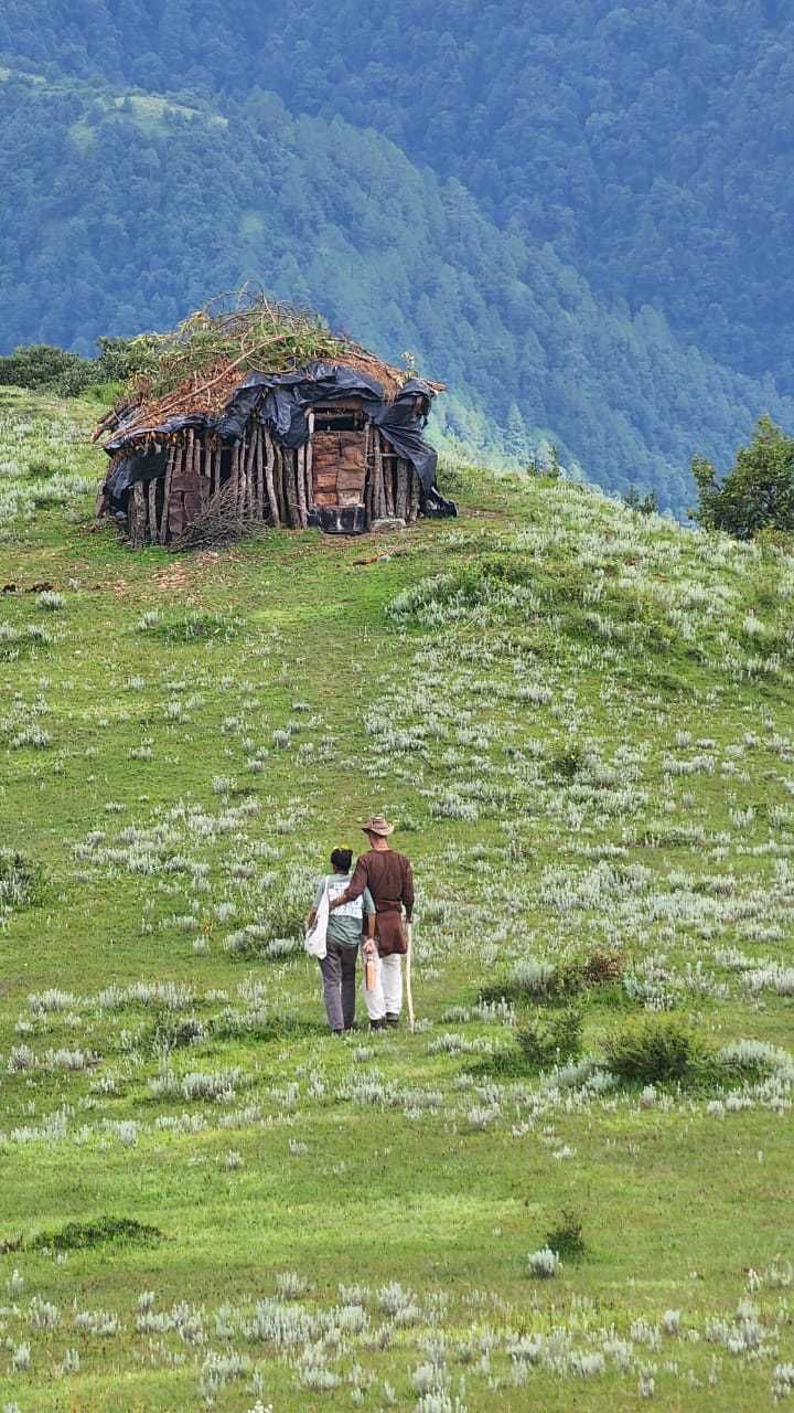
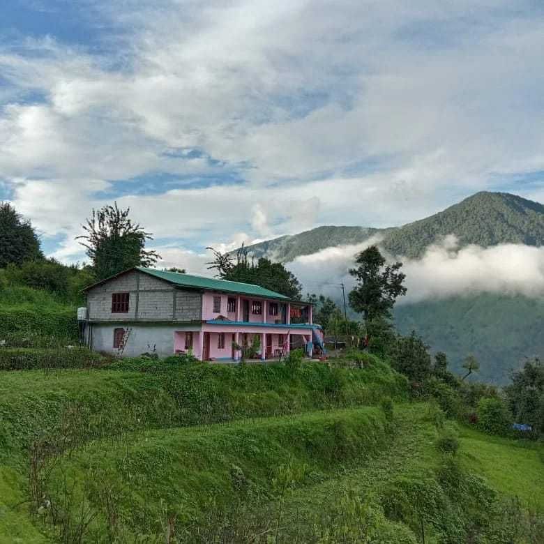
Accommodations around the Roopkund Trek Start Point consist primarily of rustic village homestays, simple mountain guesthouses, and designated camping grounds situated in the base settlements. Staying with local families provides an intimate glimpse into the traditional lifestyle, architecture, and cuisine of the Garhwal mountains. Travelers can discover and book nearby scenic campsites, homestays, and outdoor lodging through HireACamp to ensure a warm and comfortable stay before heading out into the wild.
Frequently asked questions
Where is the Roopkund Trek Start Point located?
It is located in Chamoli district in the Garhwal region of Uttarakhand, situated in the high hills past Dewal and serving as the primary launch pad for the Roopkund trail.
What is the best time of year to start the trek from here?
The most favorable periods are during pre-monsoon from May to June and post-monsoon from September to October, when weather patterns are relatively stable and visibility is high.
Do I need permits to hike from this start point?
Because the trail passes through sensitive forest divisions and high-altitude reserves, local permits and forest permissions are typically required and should be verified locally before setting out.
How challenging is the route starting at this trailhead?
The trail is considered moderate to difficult due to sustained steep ascents, rapid gain in altitude, and variable alpine conditions, requiring good physical fitness and proper acclimatization.
Where can I stay before starting the trek?
You can find rustic homestays, local village guesthouses, and scenic outdoor camping options around the base area on HireACamp.
Where you'll be
Roopkund Trail, Chamoli district, UT · 2 stays nearby shown with prices
Stays near Roopkund Trek Start Point
Book a place to stay close by
More places near Roopkund Trek Start Point
Within 20 km
Built from 0 Instagram posts by 0 creators. Every tip links back to the post it came from, and where creators disagree we show both sides.






