
Roopkund
Lake near Wan, Uttarakhand
9 km from Wan
The nearest town, for stays, food and fuel.
Roopkund is a high-altitude glacial lake nestled deep in the Garhwal Himalayas of the Chamoli district in Uttarakhand. Set amidst snow-bound terrain under towering Himalayan massifs, it is globally known for the ancient human skeletal remains visible in its shallow waters when the ice melts. Trekkers and adventure enthusiasts journey here to experience dramatic alpine meadows, challenging mountain trails, and striking views of high peaks like Trishul and Nanda Ghunti.
Getting there
By road
- From WanNearest town2 hr 55 min · 72 km
- From Dehradun7 hr 20 min · 306 km
- From New Delhi10 hr 35 min · 519 km
- From Chandigarh11 hr · 476 km
Typical drive times without traffic. Stations and airports from OLA Maps; distances and typical drive times from OpenStreetMap (© OpenStreetMap contributors); notes from creators' Reels.
About Roopkund
Written with AI from map data and general knowledge. Check prices and timings locally before you go.
The mystery and landscape of Roopkund
Roopkund lies at an elevation of over fifteen thousand feet in the Chamoli district of Uttarakhand. The tarn rests in an amphitheatre formed by the ridgelines of Mount Trishul and Nanda Ghunti. For generations, the lake has been an object of curiosity due to the hundreds of ancient human skeletons scattered along its rocky banks and resting on the shallow lakebed. In local folk legends, these remains are linked to a royal pilgrimage that incurred the wrath of the goddess Nanda Devi, while modern scientific studies have shown that groups of travellers from distinct genetic origins perished here in sudden hail events separated by centuries.
Beyond its historic intrigue, the landscape around Roopkund represents some of the most diverse high-altitude terrain in the central Himalayas. The trek traverses thick forests of oak, pine, and rhododendron before opening out into vast undulating alpine grasslands known locally as bugyals. Ali Bugyal and Bedni Bugyal are among the largest high-altitude meadows in India, carpeted with wildflowers in summer and deep blankets of snow through winter. Higher up, the greenery abruptly yields to rugged scree slopes, glacial debris, and perennial snowfields.
Trekking route to Roopkund
The traditional foot trail to Roopkund typically begins from remote villages in Chamoli such as Lohajung or Wan. From these base hamlets, trails wind upward through mixed broadleaf forests, crossing mountain streams and passing through traditional settlements before ascending toward the vast meadows of Bedni Bugyal. Bedni also holds religious importance, housing small stone shrines and a sacred pond that forms a stop along regional pilgrimage circuits.
Leaving the meadows behind, the route climbs steeply into colder, barer landscapes. Passing through rocky ridge campsites such as Ghora Lotani and Pathar Nachuni, trekkers reach Kalu Vinayak, marked by a black stone Ganesha shrine that denotes the final transition into the alpine glacial zone. The final approach via Bhagwabasa requires crossing snowfields and steep scree before arriving at the shores of Roopkund. For well-prepared mountaineers with appropriate gear and acclimatisation, trails continue higher to the dramatic ridge crossing at Junargali, which offers a sweeping close-up view of Trishul.
Read more
Best time to visit
Because of its high altitude and heavy winter snowfall, Roopkund is accessible only during two distinct windows each year. The early summer window spans from late May to late June. During this period, the lower trails and meadows burst into lush greenery, while the higher elevations still hold considerable deposits of snow. The lake itself may be partially frozen early in the season, thawing as summer progresses.
Early summer gives way to the heavy monsoon rains from July through August, during which mountain slopes become vulnerable to landslides and the trails turn muddy and treacherous. The second window opens in autumn, spanning from September to mid-October. Autumn brings crisp air, exceptionally clear blue skies, and dry trails. The meadows turn golden-yellow, and the lake is typically thawed, offering the best conditions to view the lake basin and surrounding peaks clearly. By late October, severe cold sets in, bringing fresh snowfall that closes the high passes until the following summer.
How to reach Roopkund
Reaching Roopkund involves travelling first to Uttarakhand's road network in Garhwal before embarking on an multi-day foot trek. The nearest major railway station is Kathgodam or Rishikesh, while the nearest airport is Jolly Grant Airport in Dehradun. From these transit hubs, roads follow the river valleys upwards through towns such as Devprayag, Rudraprayag, and Karanprayag before turning toward Tharali, Dewal, and finally the trailhead at Lohajung in Chamoli district.
The drive from the foothill towns to Lohajung takes between eight to ten hours along winding Himalayan roads, so travellers typically break the journey with an overnight halt along the way. Local shared taxis and regional buses operate between major towns in Chamoli, though private vehicles or pre-arranged transport are common choices for reaching the roadhead. From the road's end at Lohajung or Wan, the rest of the journey must be completed entirely on foot with camping gear and provisions.
Tips for your visit
Roopkund is a rigorous and physically demanding alpine trek that requires good cardiovascular endurance and careful preparation. Gaining significant elevation over several consecutive days carries a real risk of Acute Mountain Sickness (AMS). Travellers should budget adequate time for acclimatisation, drink plenty of fluids, and strictly follow gradual ascent schedules rather than attempting to rush the higher stages.
Weather in the high Himalayas changes without warning. Pack a layered clothing system including moisture-wicking base layers, fleece mid-layers, windproof outer shells, and a warm down jacket. Proper waterproof trekking boots with good ankle support are essential for navigating scree, mud, and snow. Always verify local environmental regulations, seasonal permit requirements, and meadow conservation rules through forest checkpoints or local authorities before setting out, and follow strict Leave No Trace principles to preserve the fragile high-altitude ecosystem.
Places to explore nearby
The Chamoli region surrounding Roopkund is steeped in wilderness, high peaks, and centuries-old mountain sanctuaries. Visible directly from the Roopkund ridgeline is the colossal Nanda Devi Peak, India's second-highest mountain, surrounded by the protected sanctum of the Nanda Devi Biosphere. Down in the valleys, temples like Nanda Devi Siddhpeeth Kurur remain central to regional devotion and heritage, celebrating the goddess honored across Garhwal and Kumaon.
For avid hikers looking to extend their time in the Chamoli hills, other classic trails sit within reaching distance of the base valleys. The Rudranath Trek leads travellers through old rhododendron woods to one of the remote high-altitude Panch Kedar temples, while routes approaching Pangarchula Base Camp offer challenging ascents and panoramas across the greater Himalayan crest. Combining these trails or visiting lower-altitude valley towns provides a deeper appreciation of the region's cultural and natural heritage.
Where to stay
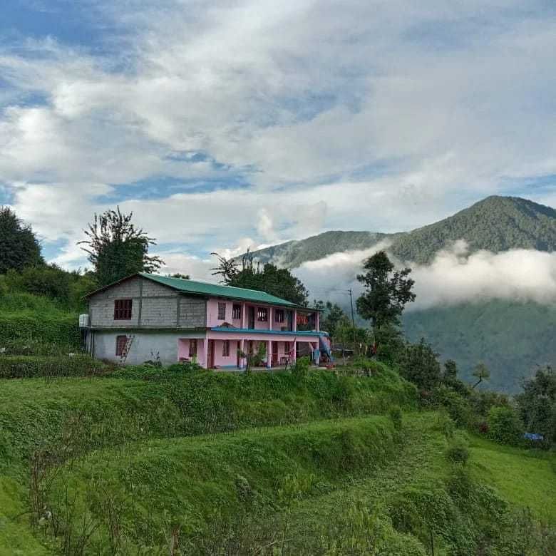
In base villages like Lohajung, Wan, and surrounding hamlets, simple guesthouses and village homestays run by local families provide warm hospitality, basic rooms, and traditional home-cooked Garhwali meals. Once you begin trekking past the tree line, accommodation is limited entirely to wilderness camping. Tents must be pitched at designated camping grounds along the route, with travellers carrying all necessary sleeping bags, insulation mats, and cooking equipment. You can find camps, homestays, and outdoor stays near the base villages of Chamoli listed on HireACamp.
Frequently asked questions
Why is Roopkund called the Mystery Lake or Skeleton Lake?
Roopkund earned this name because of the skeletal remains of several hundred people scattered along its shores and lakebed. Studies indicate that a lethal hailstorm struck travellers crossing the pass centuries ago, and the frigid conditions helped preserve their bones.
How difficult is the trek to Roopkund?
The trek is rated moderate to difficult. It demands good physical fitness, careful acclimatisation to prevent altitude sickness, and the ability to walk on steep trails, scree, and snow.
What is the best month to visit Roopkund?
The ideal periods are pre-monsoon from late May to June for pleasant weather and lingering snow, or post-monsoon from September to mid-October for crisp mountain views and thawed lake waters.
Where does the Roopkund trek start?
The trek generally commences from the village of Lohajung or nearby Wan in the Chamoli district of Uttarakhand, which is accessible by road from Rishikesh, Haridwar, or Kathgodam.
What should I carry for the Roopkund trek?
Carry sturdy waterproof trekking shoes, multi-layered warm and windproof clothing, a rain jacket, thermal innerwear, sun protection, a personal first aid kit with altitude medication, and trekking poles.
Where you'll be
Chamoli, UT · 2 stays nearby shown with prices
Stays near Roopkund
Book a place to stay close by
More places near Roopkund
Within 20 km
Built from 0 Instagram posts by 0 creators. Every tip links back to the post it came from, and where creators disagree we show both sides.






