
Papsura
Peak near Tosh, Himachal Pradesh
24 km from Tosh
The nearest town, for stays, food and fuel.
Papsura is a towering, technically challenging mountain peak rising within the Pir Panjal range in Himachal Pradesh's Kullu district. Known among seasoned mountaineers for its steep glaciers and dramatic ridges, it stands above the upper reaches of the Parvati and Tosh valleys. Adventurers and expedition teams venture toward Papsura to experience raw high-altitude wilderness and some of the most formidable alpine terrain in the Western Himalayas.
Getting there
By road
- From ToshNearest town4 hr 10 min · 177 km
- From Chandigarh7 hr · 337 km
- From Ludhiana7 hr 35 min · 378 km
- From Amritsar9 hr 35 min · 489 km
Typical drive times without traffic. Stations and airports from OLA Maps; distances and typical drive times from OpenStreetMap (© OpenStreetMap contributors); notes from creators' Reels.
About Papsura
Written with AI from map data and general knowledge. Check prices and timings locally before you go.
Understanding Papsura and its Landscape
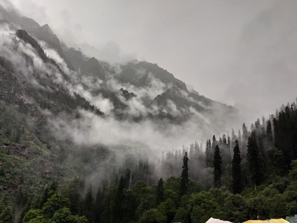
Papsura holds an iconic stature in Indian mountaineering, often spoken of alongside its companion peak, Dharamsura. Set within the rugged folds of the Pir Panjal and Great Himalayan ranges in the Kullu district, the peak commands an altitude well above six thousand metres. The surrounding landscape consists of massive hanging glaciers, serrated ridgelines, and expansive glacial basins that feed into tributaries of the Parvati and Beas rivers. Unlike accessible tourist viewpoints in the lower valleys, Papsura presents a strictly high-altitude alpine environment dominated by moraines, crevassed icefields, and sheer rock precipices.
In regional mountaineering history and local lore, the twin massifs of Dharamsura and Papsura represent dualities of light and trial, with Papsura traditionally known for its demanding faces and unpredictable high-altitude weather. Today, the peak remains an ambitious objective for experienced climbers seeking remote, technical routes far removed from crowded holiday trails.
Trekking and Mountaineering Around Papsura
Approaching Papsura involves negotiating some of the deepest wilderness corridors in Himachal Pradesh, typically accessed through the upper stretches of the Tosh Valley and its surrounding glacier networks. While standing on the summit requires specialized technical climbing expertise, ropework, and expedition logistics, the trekking approaches toward the mountain's base camps offer seasoned hikers an extraordinary adventure through untouched mountain terrain.
Routes winding past summer grazing meadows, rocky river crossings, and expansive boulder fields expose trekkers to pristine Himalayan topography. Along the way, panoramic views open up toward neighboring giants such as Indrasan and Deo Tibba. The physical demands of walking through unpaved moraine and loose scree are considerable, making gradual acclimatization and strong physical fitness essential for anyone venturing into the high amphitheatre below Papsura.
Read more
Best Time to Visit Papsura
The alpine season in this high-altitude corner of Kullu is strictly dictated by heavy Himalayan snowfall and seasonal weather shifts. For mountaineering expeditions and high-altitude trekking near Papsura, the two viable windows are pre-monsoon from late May to early July and post-monsoon from late August to October.
During the pre-monsoon period, snow bridges across glaciers remain relatively firm, although afternoon clouds and sudden precipitation are common. The post-monsoon window typically delivers crisp, stable skies, exceptional visibility of surrounding peaks, and drier rock surfaces, though night-time temperatures drop steeply below freezing. Winters bring extreme snowfall, sub-zero conditions, and severe avalanche hazards, making the high approaches impassable.
How to Reach the Papsura Region
Reaching the approach routes to Papsura begins from the town of Kullu, which serves as the principal transit hub in the district. Kullu is connected by air via the domestic airport at Bhuntar, while broad-gauge railway services connect to major stations further down, such as Chandigarh and Una. From these junctions, road routes travel alongside the Beas River into Kullu and proceed inward toward the Parvati Valley.
From Kullu, road transport leads deeper into the valley toward trailheads located past Barshaini and the village of Tosh. Beyond these terminal roadheads, all travel toward the base of Papsura must be undertaken on foot. Multi-day trekking is necessary to traverse the high valleys and reach the glaciers that flank the peak. Route conditions vary significantly depending on seasonal rains, landslides, and snowpack, so travelers should check conditions locally with experienced guides before setting out.
Preparation, Gear, and Safety
Venturing into the high-altitude zone surrounding Papsura demands meticulous preparation and deep respect for the alpine elements. The isolation of the upper Tosh and Parvati glaciers means that medical assistance or evacuation can take significant time to coordinate. Hikers and expedition members must plan dedicated acclimatization days, ascend gradually, and remain vigilant for signs of acute mountain sickness.
A comprehensive mountaineering gear setup is essential. High-performance alpine layers, including moisture-wicking synthetics, thermal fleece, heavy down insulation, and windproof outer shells, are required to manage dramatic temperature fluctuations. Rigid trekking or mountaineering boots, crampons, ice axes, UV-filtering glacier glasses, and high-factor sun protection are indispensable. Because there are no commercial amenities along the higher routes, teams must carry all necessary expedition food, water purification systems, reliable four-season shelter, and emergency communication gear.
Places to Explore Nearby
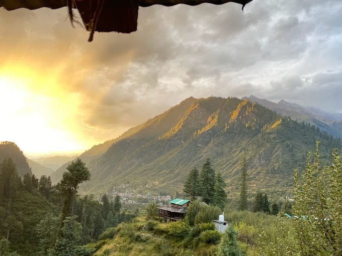
The valleys and foothills below Papsura feature several celebrated trails and mountain hamlets that reveal the charm of rural Himachal Pradesh. Lower down the valley, traditional villages such as Tosh and Pulga provide a glimpse into local architecture, apple orchards, and pine forests, offering a warm contrast to the barren glacial fields higher up.
Further along the main valley corridor, walking routes lead toward Kheerganga, renowned for its open meadow landscapes and natural thermal springs. Looking outward across the wider skyline, mountaineering enthusiasts can view other formidable peaks in the regional chain, including Indrasan and Deo Tibba. Exploring these accessible valley trails allows travelers to appreciate the grandeur of the Pir Panjal range while enjoying local culture and hospitality.
Where to Stay
Accommodations directly adjacent to Papsura are strictly limited to self-supported wilderness camping pitched on rocky moraines and alpine flats. Anyone pitching tents in this fragile wilderness must follow strict leave-no-trace practices to preserve the pristine nature of the mountains.
For travelers seeking comfort before or after venturing into the high valley, the nearby villages of Tosh, Pulga, and the surrounding Kullu area provide a diverse selection of traditional homestays, wooden cottages, and peaceful riverside camps. You can browse and book verified homestays and outdoor stays across the valley on HireACamp, giving you a restful base to prepare for your Himalayan journey.
Frequently asked questions
Where is Papsura located?
Papsura is a high-altitude peak located in the Pir Panjal range within the Kullu district of Himachal Pradesh, situated near the upper reaches of the Parvati and Tosh valleys.
Can beginners climb Papsura?
No, Papsura is a technically challenging mountain that demands advanced alpine climbing skills, specialized ice gear, and extensive high-altitude mountaineering experience. Beginners can instead hike the gentler lower trails around Tosh, Pulga, or Kheerganga.
What is the best time of year to visit the area around Papsura?
The most favorable windows for trekking and expeditions are from late May to early July and from late August to October, when mountain weather is relatively settled and the passes are free of deep winter snow.
Do I need permits to climb or trek near Papsura?
Expeditions planning to summit Papsura require formal mountaineering clearances, while high-altitude trekking in the area may require local forest or administration permits. Always verify current permit requirements locally before departing.
What accommodation options are available near Papsura?
Directly around the peak, you must carry your own four-season camping gear for wilderness stays. In the lower villages like Tosh and Pulga, you can find rustic homestays and campsites to book on HireACamp.
Where you'll be
Kullu, HP · 2 stays nearby shown with prices
Stays near Papsura
Book a place to stay close by
More places near Papsura
Within 20 km
Built from 0 Instagram posts by 0 creators. Every tip links back to the post it came from, and where creators disagree we show both sides.






