
Kedarnath Peak
Peak near Kedarnath, Uttarakhand
6.9 km from Kedarnath
The nearest town, for stays, food and fuel.
Kedarnath Peak is a prominent mountain massif in the Garhwal Himalayas of Uttarakhand, rising dramatically behind the sacred temple town of Kedarnath. Revered by pilgrims and respected by mountaineers, its towering snow-clad slopes form one of the most recognizable backdrops in the northern Himalayas. Travellers visit the region to witness its alpine beauty, undertake challenging high-altitude treks, and experience the deep spiritual heritage of the valley.
Getting there
By road
- From Dehradun5 hr 10 min · 249 km
- From New Delhi8 hr 25 min · 461 km
- From Chandigarh8 hr 50 min · 418 km
Typical drive times without traffic. Stations and airports from OLA Maps; distances and typical drive times from OpenStreetMap (© OpenStreetMap contributors); notes from creators' Reels.
About Kedarnath Peak
Written with AI from map data and general knowledge. Check prices and timings locally before you go.
About Kedarnath Peak
Kedarnath Peak stands as an imposing twin-peaked massif within the Gangotri group of mountains in the Garhwal region of Uttarakhand. Rising above the Mandakini River valley, the mountain comprises Kedarnath Main and Kedarnath Dome. The main summit presents a sharp, precipitous face that has challenged seasoned mountaineers for decades, while the dome offers a rounded, glaciated crest that serves as a revered technical climb in the Indian Himalayas.
Beyond its geographical stature, the peak holds deep mythological significance. Looming directly behind the historic Kedarnath Temple, the mountain is intimately linked with Lord Shiva and the ancient legends recorded in the Mahabharata. For centuries, pilgrims walking the traditional route up the valley have looked up at these sheer glaciated walls with awe, making the mountain an inseparable part of the sacred geography of Uttarakhand.
Landscape and Climbing Profile
The terrain surrounding Kedarnath Peak is defined by massive glaciers, knife-edge ridges, and steep granite walls. The mountain feeds the Chorabari and Companion glaciers, which carve out deep alpine bowls before feeding mountain torrents below. Because of its sheer aspect and unstable seracs on certain approaches, Kedarnath Peak is considered an advanced technical objective among mountaineering expeditions.
Climbers typically approach the peak via complex glacial systems that demand technical skill on ice and mixed rock. Snow storms can roll in quickly from the southern valleys, drastically shifting weather conditions within hours. For general trekkers and pilgrims, the peak is most often admired from base camps, high glacial lakes, or the valley floor near the temple settlement, where its south face dominates the entire skyline.
Read more
Best Time to Visit Kedarnath Peak
The ideal period to visit the region around Kedarnath Peak is during the pre-monsoon summer months of May and June, as well as the post-monsoon autumn window from September through October. During late spring and early summer, snow begins to recede along the valley trails, daytime temperatures are relatively mild, and the sky is generally clear in the mornings.
The monsoon months of July and August bring heavy rainfall across Uttarakhand, increasing the risk of landslides, cloudbursts, and swollen mountain streams throughout the Mandakini basin. Trekking and mountaineering activities largely halt during this time. Once the rains withdraw in September, autumn brings crisp air, brilliant visibility, and deep blue skies, offering some of the sharpest panoramic views of the peak before intense winter snowfall sets in by November.
How to Reach the Region
Reaching the base of Kedarnath Peak involves a journey by road followed by a long foot trail. The nearest railhead is Rishikesh, while the nearest commercial airport is Jolly Grant Airport in Dehradun. From these transit hubs, travellers can hire vehicles or use shared mountain taxis to journey along the mountain highways via Devprayag, Srinagar, and Rudraprayag toward Gaurikund.
Gaurikund serves as the final roadhead. From Gaurikund, reaching the immediate vicinity of Kedarnath Peak requires a demanding high-altitude trek that winds upward along the river gorge toward Kedarnath town. Dedicated mountaineering expeditions aiming for the peak or its surrounding glaciers depart from this base valley into high-altitude terrain under specialized guidance and official permissions.
Places to Visit Nearby
The valley surrounding Kedarnath Peak is home to some of Uttarakhand's most famous spiritual and natural landmarks. Just beneath the southern ramparts of the mountain lies Kedarnath Temple, along with the adjacent Bhairavnath Temple set on a nearby ridge overlooking the settlement. Further down the pilgrim trail, the sacred hot springs and shrine of Gaurikund Temple mark the start of the footpath.
For trekkers eager to explore the wilderness, trails branch off to high-altitude tarns like Vasuki Tal, known for its secluded alpine setting, and Kedartal across the higher ridges. The region also sits within reach of legendary peaks such as Thalay Sagar, Auden's Col, and Mount Shivling. Those exploring the broader district can visit the ancient marriage site at Triyuginarayan Temple, the meadows of Chopta, or the remote stone sanctuary of Madhyamaheshwar Temple.
Tips for Your Visit
Because Kedarnath Peak rises into severe alpine altitudes, anyone trekking in its vicinity must prioritize acclimatization. Take time to rest at intermediate elevations on the way up to avoid acute mountain sickness. Drink plenty of water throughout the day, avoid overexertion, and listen closely to your body.
Weather in the Garhwal Himalayas changes rapidly even during favorable seasons. Pack a versatile layered clothing system that includes moisture-wicking base layers, an insulating fleece or down jacket, and a windproof, waterproof outer shell. Sturdy trekking boots with good ankle support and dependable grip are essential for navigating loose scree and rocky trails. Always carry basic first-aid supplies, high-energy snacks, a reliable headlamp, and offline navigation tools.
Where to Stay
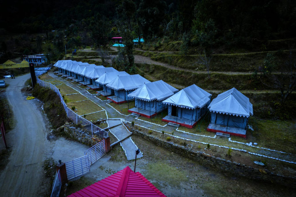
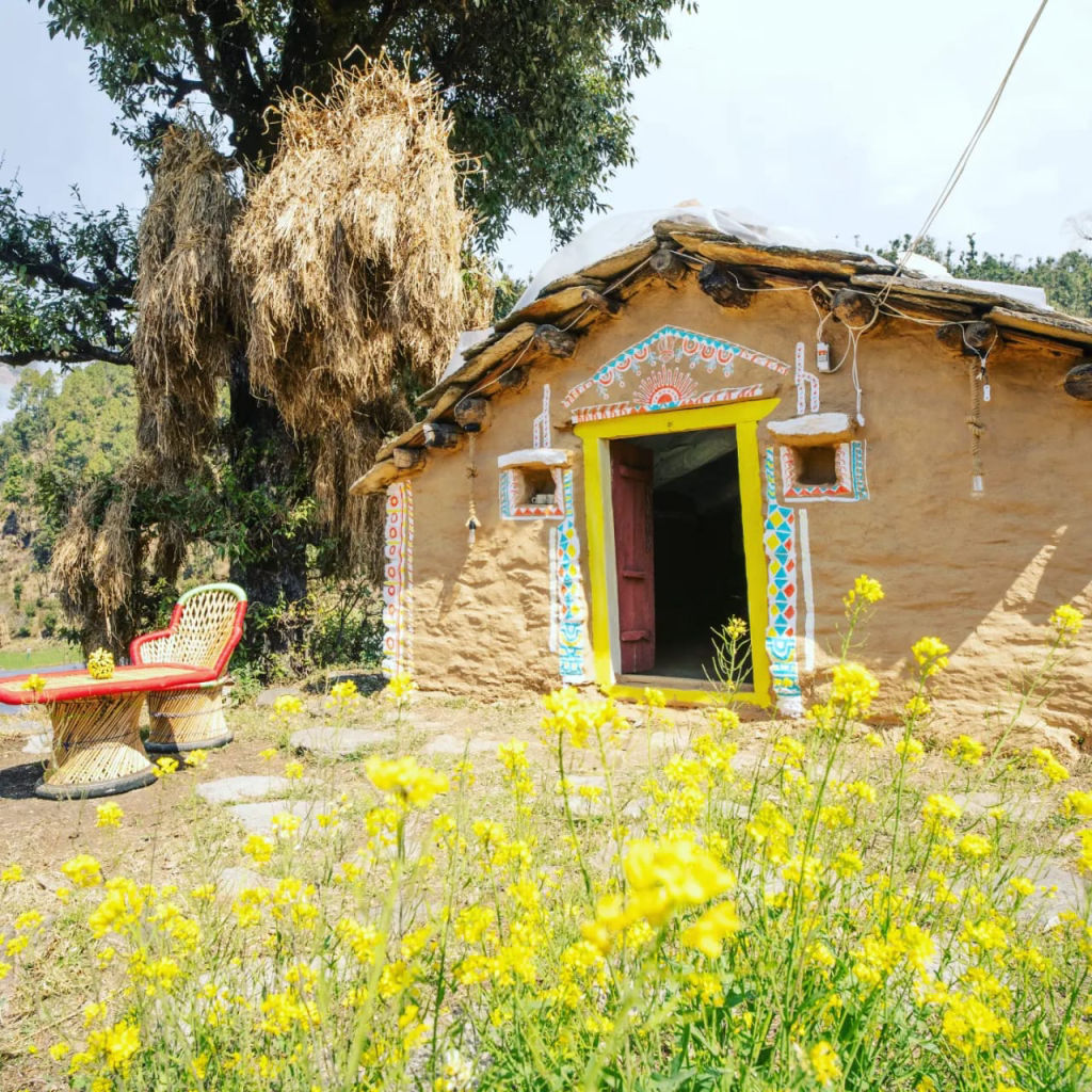
Accommodation options in the area range from basic pilgrim lodges and government rest houses in the valley settlement to wilderness campsites established along high trekking corridors. Most permanent facilities operate strictly on a seasonal basis, opening in late spring and closing before the harsh winter arrives.
Travellers looking to spend time in the scenic valleys of Rudraprayag and Chamoli can find verified camps, homestays, and rustic guesthouses on HireACamp. Booking your stay well in advance is strongly recommended, particularly during the peak pilgrimage windows of May, June, and early October when valley lodgings fill rapidly.
Frequently asked questions
Where is Kedarnath Peak located?
Kedarnath Peak is located in the Garhwal range of the Himalayas in Uttarakhand, India, rising directly behind the historic Kedarnath Temple town.
Can regular trekkers climb Kedarnath Peak?
No, Kedarnath Peak is a technical high-altitude mountaineering objective that requires specialized climbing gear, experienced guides, and official permits. General travellers and trekkers visit the valley to view the mountain from trails and viewpoints.
What is the best time of year to see Kedarnath Peak?
The best times to see Kedarnath Peak are from May to June and from September to October, when mountain weather is comparatively stable and visibility is clear.
How do I reach the base of Kedarnath Peak?
You can travel by road from Dehradun or Rishikesh to Gaurikund, and then hike the marked mountain trail up to the valley floor near Kedarnath settlement.
What are some notable landmarks near Kedarnath Peak?
Nearby landmarks include Kedarnath Temple, Bhairavnath Temple, the glacial lake Vasuki Tal, Gaurikund Temple, and the scenic meadows of Chopta.
Where you'll be
Uttarakhand · 2 stays nearby shown with prices
Stays near Kedarnath Peak
Book a place to stay close by
More places near Kedarnath Peak
Within 20 km
Built from 0 Instagram posts by 0 creators. Every tip links back to the post it came from, and where creators disagree we show both sides.






